Ground Penetrating Radar (GPR) Service Portfolio
Precision subsurface imaging for infrastructure, heritage, energy, and environmental applications.
Our Experience
Trusted Worldwide:
108 Countries
33 years unmatched GPR experience
- Subsurface Utility Detection & Mapping
- Concrete Scanning (Rebar, Post-tension Cables, Conduits)
- Void & Sinkhole Risk Detection
- Pavement & Roadway Layer Assessment
- Structural Integrity Scanning (Slabs, Columns, Beams)
- Tunnel and Bridge Foundation Inspection
- Airport Runway and Tarmac Evaluation
- Rail Bed and Ballast Condition Analysis
- Track Subgrade Deformation Monitoring
- Roadway Defect and Delamination Surveys
- Asphalt/Concrete Layer Thickness Mapping
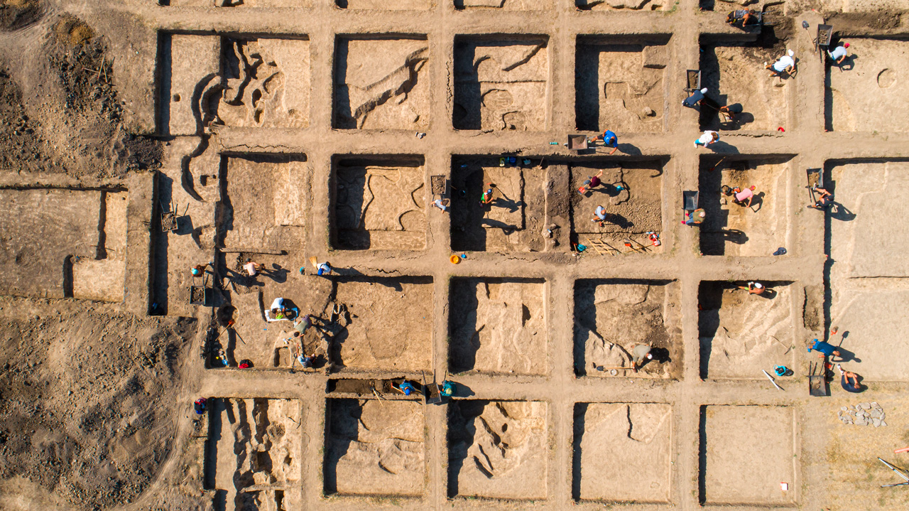
- Archaeological Site Characterization
- Non-Invasive Burial Mapping
- Subsurface Architecture Imaging
- Historical Structure Preservation Support
- Pipeline Corridor Mapping
- Leak Risk & Erosion Monitoring
- Tank Farm Subgrade Inspection
- Refinery and Facility Ground Stability Scans
- Tailings Dam Integrity & Void Detection
- Mine Site Ground Stabilization Mapping
- Mineral Exploration (Bauxite, Phosphates, Iron Ore)
- Shallow Geology Imaging for Pit Design
- Landfill Boundary Mapping
- Contaminated Ground Profiling
- Soil Layer Stratigraphy
- Manhole, Valve Box & Underground Chamber Locating
- Utility Service Connection Tracing
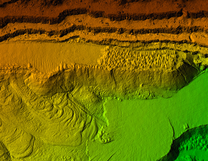
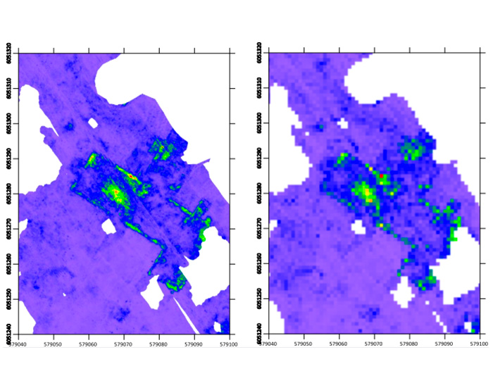
GPR Outputs & Deliverables
Clear, actionable, and fully integrable.
Visualizations
2D Radargrams
3D Volumes
Depth Slices
Isosurface Mapping
Geospatial Formats
Geo-referenced CAD
GIS Shapefiles/KMZ
BIM Utility Models
SUM Clash Detection Files
Reports
QA/QC Logs
Anomaly Logs
Executive Reports
Technical Interpretations
Integration Options
Digital Twin Embedding
COBie/Maximo Outputs
IFC File Structuring
Geolitix™ Dashboards
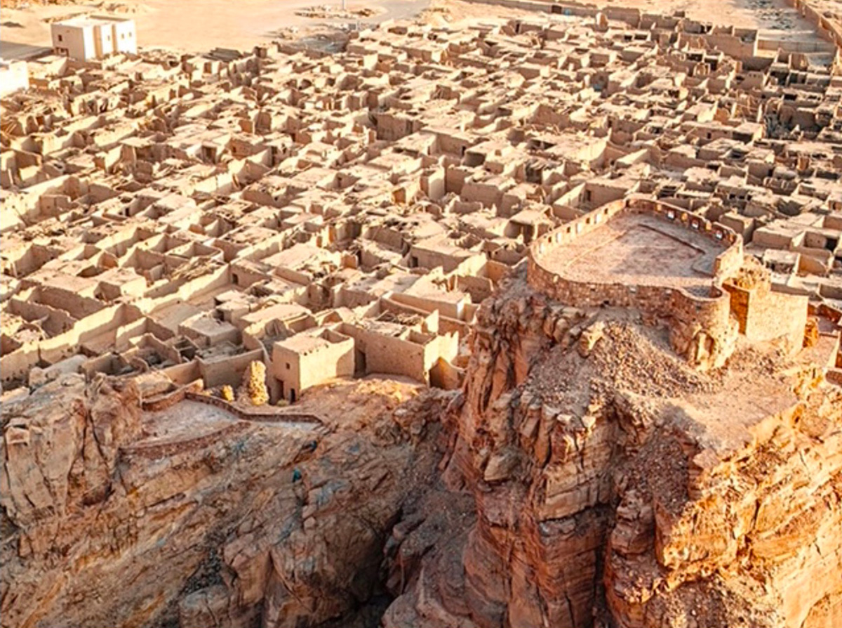
Preserving Cultural Legacies Through Digital Innovation
![]()
Vracity International Appoints Dr Jan Francke as Chief Geophysicist
Vracity International Pty Ltd is pleased to announce the appointment of Dr Jan Francke as Chief Geophysicist.
Dr Francke brings over thirty years of global field experience in more than one hundred countries, pioneering deep-penetration radar systems and advancing modern geophysical standards.
As co-founder of Groundradar and Geolitix, he has led subsurface imaging programs that shaped industry best practice.
At Vracity, Dr Francke will oversee all ground-penetrating radar operations, subsurface interpretation, and digital-twin integration across infrastructure and heritage projects.